The Laya-Gasa Trek is considered one of the most scenic treks in Bhutan. It is known as the Half Snowman
The Laya-Gasa Trek is considered one of the most scenic treks in Bhutan. It is known as the Half Snowman
Day-1: Arrival Paro (By Druk Air).
 The flight into Paro is a brilliant introduction to the spectacular beauty of Bhutan. In clear weather, magnificent views of the world's highest peaks give way to the lush green Paro valley as you land. On arrival you will be met and driven to your hotel. Evening visit to Paro market and town. Overnight at the hotel in Paro.
Day-2: Paro day hike to Taktsang monastery
The hike which is all the way uphill takes about 2 /3 hours through villages and pine forests. The monastery clings to a huge granite cliff 800 meters from the Paro valley. Return to Hotel
Day-3: Paro - Shana [17 Kms, 5/6 Hours]
The trek starts from Drukgyel Dzong at 2580m with a short downhill walk on a wide trail. The trail climbs gently traversing through well maintained rice terraces and fields of millet. The route later enters an area of apples orchards and forests. Soon the valley widens and you reach the army post of Gunyitsawa at 2810m. This is the last stop before Tibet. At 2870m, just beyond Sharma Zampa, there are several good places in meadows to set up our tents surrounded by trees.
Day-4: Shana - Soi Thangthangkha [20 Km, 7/8 Hours]
The trail again follows Pa Chu (Paro River), ascending and descending through pine, oak and spruce forests. Hot lunch will be served after crossing the bridge towards the left side of the river. After lunch we follow the river and climb up through rhododendron forests and finally crossing the bridge again, reaching to an altitude of 3,750m.
Day-5: Soi Thangthangkha - Jangothang [19 Km, 7/8 Hours]
The path ascends for a while till you reach the army camp. We then follow the river above the tree line enjoying the views of the surrounding peaks. Hot lunch will be served inside a yak herder's camp. A short walk into the valley will take you to the camp at Jangothang at an altitude of 4,000m. From here, the view of Mount Chomolhari and Jichu Drake is superb.
Day-6: Rest Day at Jangothang
Enjoying the superb view around.
Day-7: Jangothang - Lingshi [18 Km, 7/8 Hours]
The trail follows the stream for half an hour and crosses the bridge to the right side. We start the climb up to the first ridge with breathtaking views of Chomolhari, Jichu Drake and Tsrim Khang. We then walk towards the valley before ascending to the pass at an altitude of 4700m. After the pass it's a gradual descent to the Lingshi camp, enjoying the panoramic view of the peaks and Langshi Dzong. Camp at the altitude of 4000m.
Day-8: Lingshi - Chebisa [10 Km, 5/6 Hours
Today is an easy day and pleasant walk through villages and yak herders camp. After lunch, a short walk will take you to Chebisa village. We stay by the side of stream at the altitude of 3850m.
Day-9: Chebisa - Shomuthang [17 Kms, 6/7 Hours]
Today begins with a steep climb up a ridge to Gubu la at an altitude of 4500m, taking nearly four hours. After the pass we descend to a lunch stop, through rhododendron bushes. Afternoon continue along the up and down path, after crossing the stream, through rhododendron forests and yak herders camp. You may see Blue Sheep now and then. Camp at altitude of 4,250m.
Day-10: Shomuthang - Robluthang [18 Kms, 6/7 Hours]
The trek starts with a climb to Jari la at the altitude of 4700m. Then descend to Tasharijathang valley, the summer residence of rare Himalayan Takin (national animal of Bhutan) From here we may have to cross the stream as most of the time the foot bridge is washed away. After crossing the stream towards the left, the trail ascends till we reach Robluthang at an altitude of 4200m.
Day-11: Robluthang - Limithang [19 Kms, 7/8 Hours]
It's a long climb up to Shinje la pass (altitude 4900 m). The view of the mountains from the path is stunning. After the descend to Lemithang. The path is quite narrow and you may have to cross stream again and get wet. The last part of the trek is very interesting with the view of Mount. Gangchey Ta peak. Arrive at the site at the altitude of 4100m.
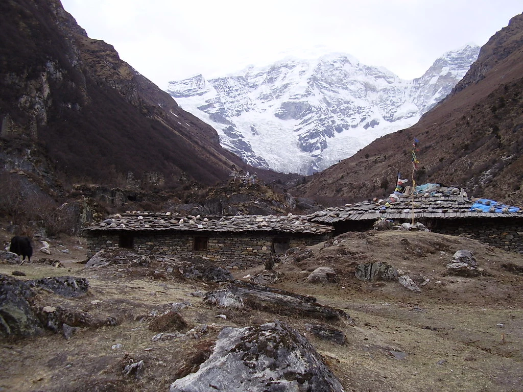
Day-12: Limithang - Laya [10 Kms, 4/5 Hours]
In the morning you wake up with a superb view of Gangchey Ta peak in front of you. The walk to Laya is very pleasant with wonderful views. You will pass through a camp forest, filled with moss and singing birds. Arrive at Laya village, the second highest settlement in the country, at the altitude of 3800m.
Day-13: Rest Day At Laya
Explore the village.
Day-14: Laya - Chamsa [19 Kms, 8/9 Hours]
Descend to army camp and join the Mo Chu (mother river of Punakha). Follow the river till you cross the bridge. After the bridge it is up and down several times, through juniper and fir forests until you reach the camp at Chamsa at an altitude of 3800m.
Day-15: Chamsa - Gasa Tshachu [14 Kms, 6/7 Hours]
Walk for about half an house over flat land till the Bele la pass. Its down hill all the way to Gasa Tshachu. Lunch at Gasa village at the altitude of 2700m. After lunch visit the village and Dzong. The Dzong was built in 17th century by the first religious King, Shabdrung Ngawang Namgyal, to protect the valley against Tibetan invaders. Then proceed to Gasa Tshachu (hot spring) for camp at an altitude of 2200m.
Day-16: Gasa Tshachu Rest Day
After a long trek, this is the place to relax.
Day-17: Gasa Tshachu - Damji [18 Kms, 5/6 Hours]
The path continues ascending and descending through heavily forested areas and wild orchids. In this area, there are leeches so one must be careful. Camp nearby the village at an altitude of 2400m.
Day-18: Damji - Tashithang - Punakha[16 Kms, 5/6 Hours]
It is the last trekking day. Continue following the Mo Chu river down through heavily forested area till you reach Tashithang at an altitude of 1,620m. Connecting Horizons Adventures transport will be waiting to drive you at Punakha (15 kms), following the river all the way. Overnight at the hotel in Punakha.
Day-19: Punakha - Thimphu
Morning sight seeing in Punakha and Wangdiphodrang valleys visiting Dzong and the local market. Afternoon drive to Thimphu. Overnight at the hotel in Thimphu.
Day-20: Thimphu
Today city tour of Thimphu. Visiting Memorial Chorten, Tashichhodzong, National Library, Painting School, Traditional Medicine Institute, Handicrafts Emporium. Overnight at the hotel in Thimphu.
Day-21: Thimphu - Paro
Morning for shopping and at leisure. After lunch drive to Paro visiting Simtokha Dzong en route. Overnight at the hotel in Paro.
Day-22: Paro Depart
After early breakfast in the hotel, drive to the airport for flight to onward destination.
End of services
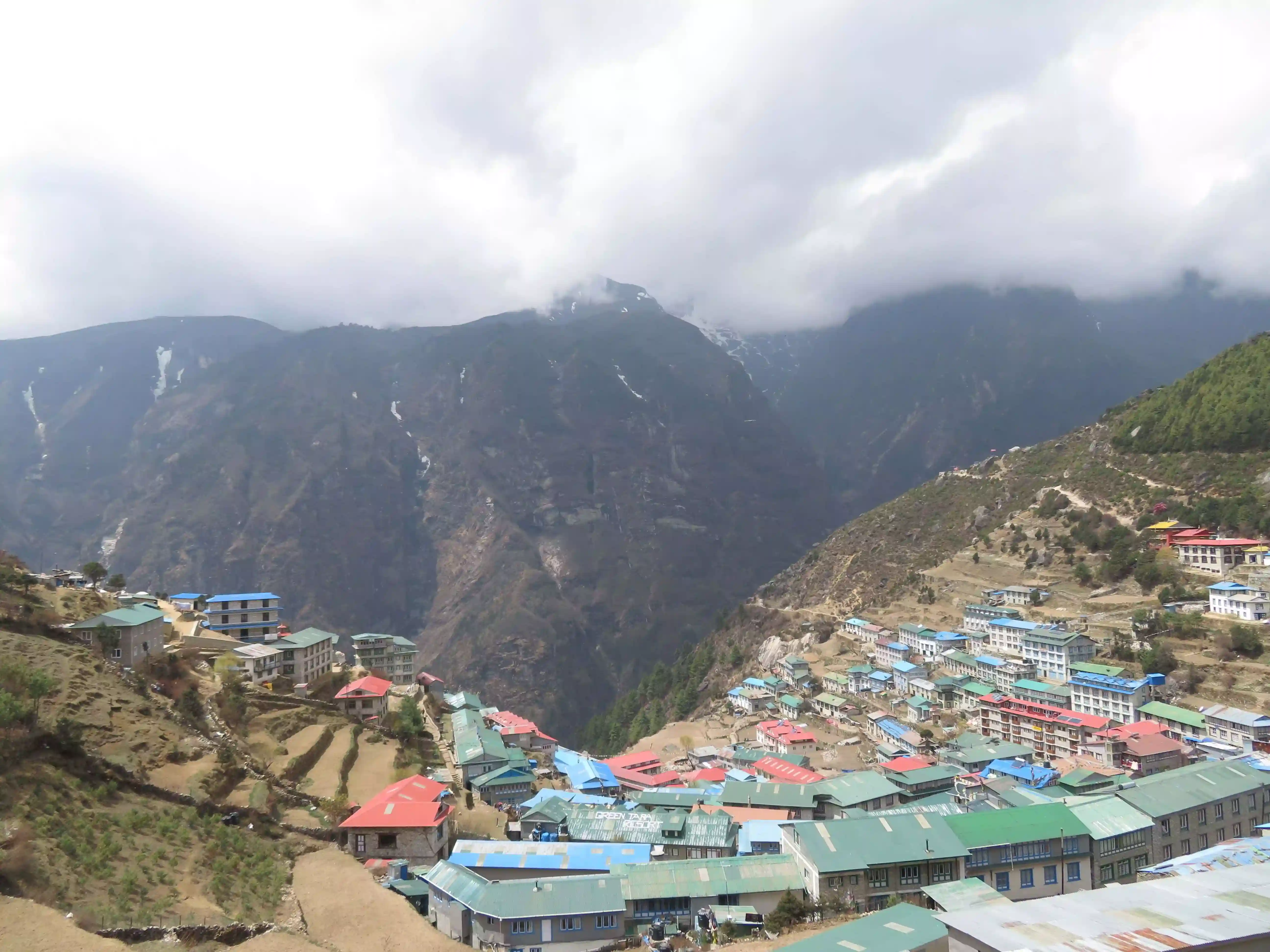
The Baazar Near the Top of the World
There is very little that Namche lacks. It even boasts the world’s highest Irish pub offering everything from Jameson whiskey to Guinness. It sports a sign as you enter that strikes to the heart and soul of what Namche and her people are all about.… Continue reading
Between Cho La, Kongma La, and Renjo La, which pass is more difficult?
Well for a start the three passes trek is incredible and if you can do all three then do. Each pass has its own difficulties. Renjo is a long slow pass and more of a ridge than a pass itself. It is spectacular and more remote than the other two as it goes via the … Continue reading
How hard is it to hike to Everest Base Camp compared to Kilimanjaro? Most people think Everest Base Camp is higher than Kilimanjaro but surprise surprise, it is not. Base camp of Everest (or rather Kala Pathar – the little hill you climb up above base camp) is actually 5545m, whereas Kilimanjaro summit is 5895m.Continue reading
Everest Base Camp or Advanced Base
We are often asked which is the better of the two treks, Everest
advanced base camp from Tibet (north side) or Everest base camp from
Nepal (south side). It really is not an easy question to answer as it
all depends on what you are hoping to get out of the trek. Advanced
Everest Base Camp - 6340m Tibet … Continue reading
Altitude is much like elevation only it refers to the distance measured
above a specific planetary point, and in most places, this is the
distance above sea level. So if we live at the sea, how do we train for
high altitude? Getting technical about O2 and altitude At sea-level, the
concentration of oxygen in … Continue reading
KEEPING YOUR PHONE ALIVE ON at altitude
Well the answer is quite simple – snuggle up with all of your batteries
at night or as soon as the temperatures drop. Packing a spars pair of
warm thermal and mohair socks will go a long way to creating a nice warm
package for all of your batteries. Continue reading
What is happening with Everest Advanced Base Camp in 2019?
Well, let’s cover some history first… the history of this area has been subjected to several issues over time. For a start, Tibet is to be closed to tourists between 30 January 2018 and April 1 April 2019 as usual.
Continue readingThe terms seem to be used interchangeably on many websites and travel books. It becomes even more confusing when some companies sell their boots as 'trekking boots' and then proceed to state that they can be used on long hikes. And when is a walk a trek and when is it a hike? It becomes … Continue reading
these boots are made for walking
Kilimanjaro, the Inca Trail, Everest Base camp or a simple short hike on local trails. We all dream of these amazing places and for some of us, turning those dreams into a reality is like a brand new lease on life.
Continue reading